Tuesday, May 31, 2016

Leaving America...Briefly

Our Memorial Day weekend in Orcas Island, WA was memorable indeed. We had a fantastic visit with cousins Ron and Susie in their beautiful home and property near the cool village of Eastsound on Orcas Island.

Debbie and her cousin Ron shared their Cory family memories one evening over cocktails and we had a lot of laughs (and yes, cried a little bit too) hearing their stories spanning 70 years. Susie and I had of course heard some of them but there were some new nuggets that had us in stitches...a very fine evening was had by all.

Ron and Debbie solving the world's problems


Now to the title of today's post...yes, in coming out to Orcas Island we briefly left America. Seems recently a certain US Border Patrol agent had been very zealous in his duties and was a constant presence on the ferry linking the island to the mainland that left many local residents feeling like they were leaving the country to come to and from their island homes. Apparently this has subsided a bit as the agent is no longer in the area but the attitude with the local residents persists. When someone leaves the island to go to the mainland they are said to be "going to America".
This also has some historical context as well. Seems it wasn’t a foregone conclusion that Orcas and the other San Juan Islands would be a part of the United States until a German arbitrator settled a boundary dispute between the United States and Britain in 1872. Thirteen years earlier, the two nations nearly went to war after an American settler shot a pig owned by an Irishman who worked for the Hudson Bay Company (you really can't make this stuff up, right?). The so-called Pig War set in motion a process that eventually placed the border at the Haro Strait, which separates San Juan Island from Vancouver Island in Canada.
So based on these two observations we briefly left America to visit Orcas Island.

Now, what have we been up to you ask?

Saturday morning Ron and I were set to go shrimping - who knew shrimp lived in these cold waters, but they do good friends, and nice ones too - and his buddy Dick, the guy with the boat, called it off at the last minute due to high winds and rough sea conditions. Now when an experienced helo pilot with Vietnam war experience calls off an adventure, I'm all ears! This was really cool...so Ron and I are sitting at the local breakfast joint grabbing a quick bite before the fishing and the owner of the restaurant comes over to our table, hands Ron the phone and says..."Ron, Dick's on the phone". Now that is small town action right there, so cool! Ron, please extend my sincere thanks to Dick for the offer and tell him we'll nail 'em next time.
Here's a shot of Ron's "shed" containing every conceivable piece of fishing gear an angler could want...I was drooling. Ron fixed me up with a nice light weight tackle set up for fishing in Canada. Thanks Ron, the first cast will get a hard hit, I know it!


We drove up to Mt. Constitution, the highest point in the San Juan Islands with spectacular views of Mt. Rainier/Olympic Mountains to the south, Mt. Baker to the east and Vancouver and the BC coastal range to the north and ALL of the San Juan Islands.
Check out these views:


The views are best appreciated by climbing the observation tower to take it all in....


One of our favorite places we visited was Deer Harbor where we enjoyed a leisurely ice cream cone and chili dog on a gloriously sunfilled afternoon on the boat dock.


And, Doe Bay was lovely as well.....


I also enjoyed a nice hike out to the beach at Obstruction Pass early one morning and caught a decent photo for your enjoyment.....


Now, in closing out this post I'd like to mention we are not the only ones headed north. See, these hummingbirds are currently residing on Ron and Susie's terrace enjoying their fine hospitality as much as we did. They will be here till mid June and then complete the last of their journey from the Andes in South America to Alaska. Hey, if these little guys can do it, I'm liking our chances.


Finally, we want to say thank you to Susie and Ron for your generous hospitality and wonderful company, we had a great time and it was so nice to hang with you kind folks...thanks for sharing your slice of heaven with us...we're so happy for you guys!

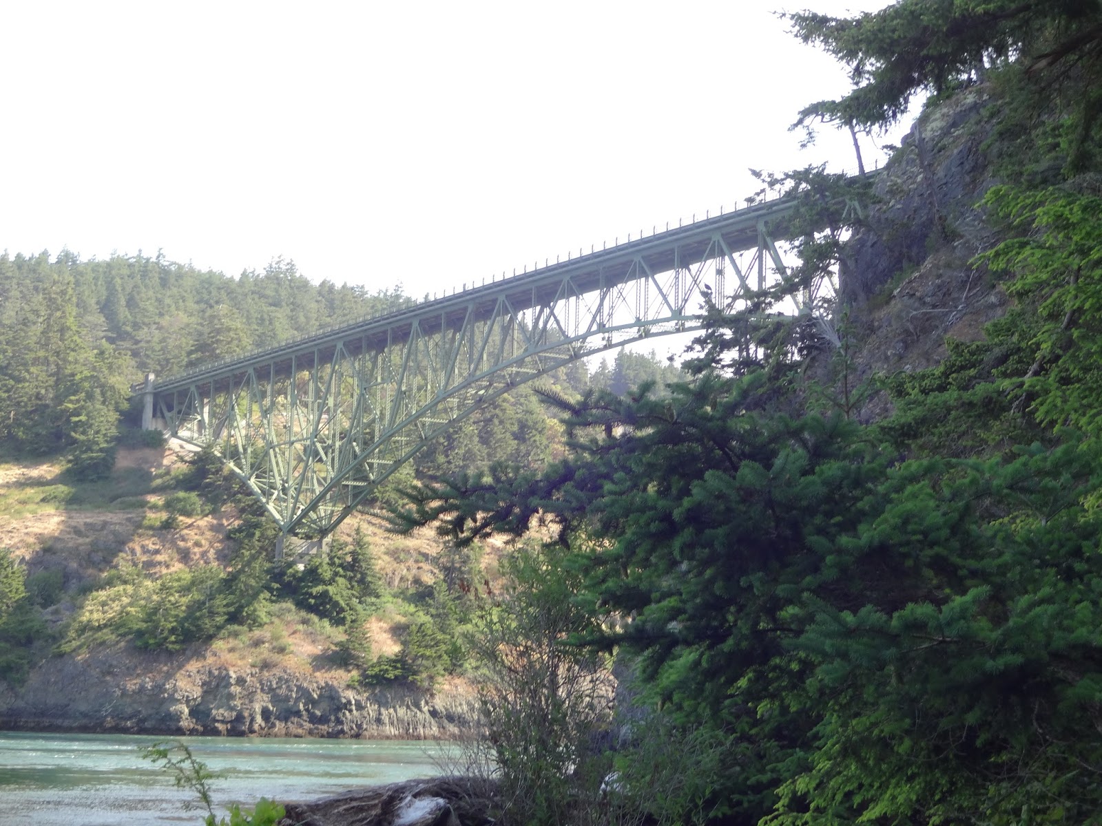
Next up: this is the ferry taking us back to America...

but only for a couple of hours as we're scheduled to cross the border into Canada later this afternoon.
I don't know, suddenly I'm starting to feel all Vancouvery....later fine folks and thanks for tagging along.

Monday, May 30, 2016

Happy Memorial Day

This is a day that I like to reflect and remember. Many have given all for us to enjoy this day and they should not be forgotten on this important day.
Some of my fondest  Memorial Day memories come from my younger years in Pittsburgh, PA. It always marked the first days of summer with baseball, watermelon and playing cards pinned to the forks of my bicycle for that cool noise given off by the passing spokes.
So today I will keep the post brief as I'm sure all of you will be enjoying the day off and time making memories with your family.
I will leave you with this photo from cousins Ron and Susie's bee-u-tiful home on Orcas Island...here's Ron and color guard dog Luci handling the colors.


Tomorrow we leave Orcas and head towards the Canadian border. While on the ferry tomorrow I will write a post about our wonderful time here on Orcas Island and share with you the great hospitality and fun we had visiting with Ron and Susie.
Happy Memorial Day everyone.

Wednesday, May 25, 2016

Anna C - a Real Honest to Goodness Town

Before I dive into the topic of the post title, let me tell you all a little bit about Deception Pass State Park where we domiciled last night.

I think we may have been deceived.

We check in noonish  and, I should have been tipped off by this, the friendly ranger says, "well, go on thru and pick out a few campsites that you like, come back and I'll see if they are reserved for others or not". OK, fair enough. But, out of curiosity, how many reserved sites do you have? Oh, a couple, actually two. Well, how about marking those two sites on the map for us and we'll choose from one of the other 158 available sites. Got her to agree to this process, so off we go to find a site.
We pick out a great site and take our standard 5 minute set up, just sit down outside on a beautiful afternoon, say the ahhhsss...and then - all hell breaks loose.
Now I've been thinking all along, why is this place so deserted? Such a beautiful park situated at the entrance to Deception Pass and I then recalled driving by the Naval Air Station (NAS) Whidbey Island facility right before entering the campground.

About 500 feet above us came an F/18 Super Hornet on approach...awesome!
Now if you ask people to come out and witness an F/18 Super Hornet, 500 feet above you with twin F414/General Electric/400 turbofan power plants roaring at full throttle with afterburners deployed, I'm at the head of the line for sure. Shakes every bone in your body and leaves you marvelling at the engineering know how to generate so much thrust in such a relatively small package.
But....these Navy fly boys were doing take offs and landings and one of these flew over us each and every minute for...I kid you not...10 freaking hours! They went till 11 PM....so much for quiet time at the campground, we took advantage and cranked some loud tunes fireside.
I asked Debbie to go back to the park ranger to see if we could get a site a little closer to the airfield, like maybe a site on the runway, with full hook ups if you please.
Unreal....we laughed so hard, it was sheer madness I tell you.


Info sign at the State Park explaining how it just might get "a bit noisy at times".

Also had time this morning to hike out to see the bridges spanning Deception Pass. In my opinion, the only way to properly view or photo a bridge is from under it looking up.

Ain't she a graceful structure....striking.


Now, back to the post topic.
Before our trip I mentioned to some friends that we were going thru Anacortes, WA and they advised...not much to see there, it's OK but head to the San Juan Islands, which we are doing tomorrow morning.

View of Debbie and Anacortes in the background taken from the nearby headlands Cape Sante....


But, we found this town to be a real treat. It has all of the things we look for in a town - nice restored downtown with preservation at the heart; friendly townsfolk; industry to support the local economy and citizens that are proud of their City. Found all of this in Anacortes and then some.
In my opinion a real town needs a tablespoon of this....


And a pinch of this....


And yes, even a dash of this....


Hey Cory, I'll bet you're thinking they named this town after you and your lovely bride - Anne Marie/Cortez, Anna Cortez? No?
Well, nice try 'Tez but here's the true dope - seems the town's name was penned by the post mistress one Anna Curtis back in the late 1800's (thanks local historian Susie Ward for this factoid!).
Took a bike ride along their excellent Thompson Trail and did my usual bicycle recon of the town. It was a lovely day and I thorougly enjoyed the ride, the sights and the friendly folks I met along the way.


You're welcome Anna Curtis and thanks for sharing your real town with us.
Well, we're off to Orcas tomorrow morning, I'll post again once we hit landfall on the Island.
Cheers everyone, thanks for reading.


Tuesday, May 24, 2016

We're Off to See the Wizard

Where might we find this wizard? In the Emerald City, haven't you seen the movie? Yes, but how do we get there? By following the yellow brick road of course. You sure you've seen the movie?

On Saturday we left the Olympic NP and headed off to Seattle, the Emerald City. Now the road was not paved with yellow asphalt or concrete but a good chunk of the WA State highway systems Right of Way are lined with  brilliant, yellow flowering bushes - I'm not very good at id'ing flowers but Debbie thinks they are goldenrod or maybe acacia. There is most likely some WA State DOT highway design standard that requires these to be planted and maintained because they are everywhere, for miles and miles and miles, rather nice we'd have to say.


Crappy photo thru dirty RV windshield of WA State Highway flowers.

So we set off to see the emerald city following the yellow flowered right of way......

We nestled into the Trailer Inns of Bellevue RV Park and despite my first impressions and rather harsh review in an earlier post the place worked out perfectly for us. If heading this way in an RV and plan on spending time in metro Seattle we would recommend it. The location is what makes it great, 10 minutes to downtown (an hour if traffic is bad and at certain peak times the traffic can be horrendous in this town) and about an hour or so to Mt. Rainier. It's basically a parking lot next to I-90 with mostly permanent residents but everybody minded their own business and it stayed pretty quiet plus the facilites were well maintained. Didn't see any crack heads, a couple of borderline looking folks but they were cool.

We found Seattle to be a very nice place as far as big cities go. The skyline is breathtaking especially at night and they have some great restaurants and fun entertainment venues.

I don't know, big cities just don't do much for me anymore. I spent time travelling to big cities for work with many business trips to Seattle, so maybe that tainted it a bit for me ....but, meh. First visit for Debbie and she really loved it so that part was nice for us to visit the tourist spots like the space needle, canal locks/fish ladder and Pike Place Market.

We hit Pike Place Market on a sunny and warm Sunday afternoon and it was a mob scene. As you guys know, not exactly Howie's cup of tea....yeh we saw the dudes throwing the fish around (which was fine entertainment for about 4 minutes) and then spent 90 minutes watching a million tourists try to jam their way around a several block area.

To somewhat escape the tourist throng we headed over to the Chittenden locks in nearby Ballard. An Army Corps of Engineers(ACOE) facility built in 1907 that lifts/lowers boats between the freshwater/upstream Lake Washington and the saltwater/downstream Puget Sound by way of canal locks. Very nice park/gardens and a big breather from the tourist crowds, although this place was rather busy too, but more spread out in a large park like setting. In addition to the locks and gardens it also includes the first ever salmon fish ladder as a way for spawning salmon to bypass the locks on their upstream voyage. It was designed and built by ACOE engineer Hiram Chittenden in 1907 but unfortunately for us it was closed for repairs so no salmon viewing. Google the Chittenden locks for more info, pretty cool history.


Monday we did laundry in the morning and then went out past Issaquah (seems every town name in WA either ends with a quah, ish, harbor or bay or starts with port) to catch a close glimpse of Mt. Rainier but it was a cloud covered day with the clouds dropping down to about 4000 feet - not too advantageous for trying to view/photo a 14,400 foot peak, the highest in WA.

So what to do - well let's have a drink and get something to eat. Had a very nice lunch in a hamlet called Black Diamond and took a little stroll along their boarded sidewalk.

Saw an antique shop along the way and Debbie asked if we were interested and I said only if they sell an antique gun that you can purchase and shoot me in the head with before entering, in that case, yes, let's go for it. In retrospect I think a simple 'no thanks, not interested' would have sufficed. I'm such a great travelling companion, aren't I?

Sorry folks, not to sound too down on the place we really did enjoy our stay in Seattle...it is a fun town with nice people and we had a great time there. It was also nice to pack up and move on if you get my meaning.

As I was uploading photos to the blog I realized we did not take many photos while in Seattle. I guess we got into rush rush City mode and barely stopped long enough to snap any photos. Sorry, hey at least you can find a million gorgeous shots of Seattle and her attractions on the internet. Go for it, really is a beautiful City.

Also, we found no wizard here although we tried finding the troll underneath the Aurora Bridge with no luck. Maybe next visit, or not.
Today, Tuesday, we head noth towards Anacortes - Anna-C - as the locals say, I guess. We're taking the ferry across to Whidbey Island and plan on camping tonite at Deception Pass SP near Oak Harbor.

We have reservations for the Thursday morning ferry out to Orcas Island from Anna-C to visit with cousins Susie and Ron Ambler, we can't wait.
We've made prior arrangements to store the RV in Anna C during our visit out to Orcas. Taking a big motorhome out there is costly and just not appropriate for a small community. So we'll leave the blue whale in Anna C and take the Fit out to swim with the orcas.

Oh, speaking of whales, I'm guessing with a name like Orcas Island there should be some whales of the killing type lurking about. I'll definitely have time for these kinds of photos, don't you worry!
We'll see...later everyone, thanks for riding along.

Sunday, May 22, 2016

Science or Fairytale?

Friday, Debbie and I were discussing the virtues of science vs. fairytale. We sometimes get into talks like this and we're never really sure how they all begin but today's debate could be accurately pinpointed to a tale we heard earlier in the day.

You see, we were talking to a very friendly and competent (yet know-it-all) kind of a park ranger - you know the type I'm talking about, we've all encountered them at some point. All I can say is that these park rangers must have to deal with some absolute imbeciles each and every moment of a working day, God bless them. But jeezus, they talk to you like you're a kindergartner - oh, that's a lake, no way, I thought it was an ocean??

Which brings us to Lake Crescent, a beautiful, azure glacier fed lake in Olympic NP. My pictures of it are crap so you'll need to google it to catch the essence - very beautiful.

The park ranger lays a fact sheet on us listing the Lake's stats and on the flip side has this story that I am paraphrasing from the NPS produced fact sheet:

Mount Storm King - An Indian legend tells of the creation of Lake Crescent...seems long ago there was much fighting amongst two tribes along a small river that flowed thru what is now Lake Crescent. These disagreements escalated into a full on battle that lasted 3 days. The mountain spirit, one mean and angry dragon with an attitude, became very upset and hurled a huge boulder into the river killing the warriors and damming up the river to create present day Lake Crescent. It is said that tribal members still refuse to visit the area where their forefathers were killed.
Now, here's the clincher....Geological studies and records support the idea that a large scale disturbance affected and may have created Lake Crescent.
End of NPS paraphrasing.

You see this could have been caused by a major landslide (Science) or from a spirit dragon hucking a huge boulder (Fairytale).
We're not going to go too deep on this one folks, I think just the shallow end of the pool will do for now. In fact, when it comes to this spiritual/fairytale stuff I'm still wearing floaties on my arms. However, when it comes to science I'd say I can venture into the deep end, but only with lifeguard supervision.

So here's my point....I think science does an excellent job of explaining the details of past events and with a large degree of accuracy - although we're never really convinced WHY certain things happen. Here's where fairytales step in and fill the void.

So what do you think in this instance - geology or mythology? I'm going with geology all day, others may have differing opinions.

Marymerre Falls hike at Lake Crescent...very beautiful


Let's catch up on our whereabouts the past couple of days.....

Are you guys fans of the book(s)/movie(s) Twilight? I'm not and could not really care one way or the other but we were apparently in the area where the story is based - Forks and La Push, WA. For those not familiar it's a vampire fantasy type dealio and seems to be very popular (refer to earlier discussion on science vs. fairytale).


We saunter into the local all-in-one restaurant, grocery store, fishing guide, motel, gas station in La Push and they are definitely wringing all of this Twilight commercial hype to the hilt. So I ask the owner, a lovely woman, a bunch of questions about vampires, like - are they real and are any of them currently on the premises. I think she was getting a bit annoyed at me because her answers all had a hint of sarcasm. We shortly thereafter vacated the Forks - La Push metro area on Wednesday morning.
We took a 20 mile ride along a beater Forest Service gravel road deep into the woods along Rugged Ridge and snapped a few nice photos. It was almost like hiking deep into the forest as we did not see anyone and saw some beautiful country - and we avoided the 20 mile hike, not too bad.

Wednesday afternoon found us at the Sol Duc campground where we stayed for 2 nites.
The highlight of the stay was the Sol Duc (sole duck) waterfall that Debbie and I hiked. It was a hilly 2 miles out and back with some rough trail along the way and Debbie rolled right on thru - I was so happy she made it. That's one tough gal making the final step...


We also spent an evening at the local hot springs pool and restaurant with a nice relaxing soak and outstanding meal.

Before we left Sol Duc Friday morning I pulled a hike up, and I do mean up, to Mink Lake. The info sign at the trailhead said it was a 2.5 mile long one way trip but did not mention that 2.495 miles of it was steep, uphill along a very rocky and tree root strewn trail. I almost gave up but soldiered on because I knew you guys wanted to see a nice photo of Mink Lake on a crisp and peaceful lake. Hey, I do it all for you guys! At least the return was 2.495 miles downhill......


Ahhhhh..........made it!

We then moved on about another 40 miles and posted up at the Heart O' the Hills section of Olympic NP - I can't believe we're still in this Park, it never ends! - just south of Port Angeles, WA, a fine little town by the way, where we enjoyed a nice lunch and walk along the waterfront.


Yours truly, at one with the cormorants in Port Angeles, WA.

Saturday we headed off to Seattle where we caught a Sounders soccer game Sat nite and will sightsee Sunday and Monday.


Yes, they were as up tight as they look.

Currently residing at the Trailer Inns of Bellevue - let's just say the use of the word 'Inns' in their title is way misleading. It should be Trailer Dumps of Bellevue, but it is 10 minutes from downtown Seattle and is generally pretty quiet. We're only here for sleeping and high speed internet
so it's working out just fine. Haven't seen any crack heads yet, but my head is always on a swivel.

Which leads me to this conclusion...within 4 hours of driving we went from an environment where we were worried about wild bears in the middle of nowhere to worrying about crack heads in an urban setting - what a strange, strange world we inhabit - wouldn't you agree?

I'm tired and going to bed, sleep well all.

We'll post again in a day or two with our happenings in Seattle, thanks for reading.

Friday, May 20, 2016

Pushing on to La Push, WA

Monday morning we left the Hoh River Rainforest campground after a great but short stay. We had a hankerin' for more beach time so we moved over to the Mora Campground about 20 or 30 miles away in La Push, WA yet still within the Olympic NP.
Before leaving I got up early and walked the Hoh River Rainforest trail before the mosquitoes were awake.


I could tell I was the first trail customer of the day as my face was breaking a spider web spun overnight across the trail every other stride it seemed. What a beautiful walk it was. Friend Pete terHorst has hiked this previously and told me beforehand to just keep walking...it gets better and better the deeper you move into the rainforest. You were spot on Pete, thanks for the tip as I thoroughly enjoyed myself right from the start.


Now with my bear encounter the previous evening don't you know my head was on a swivel. I would stop at the higher points along the trail and look 360 degrees and listen very carefully. No bear sightings, which was fine by me being all alone and about 3 miles deep into the rainforest.
This was on my mind.
I did spy this little guy, have no clue what it is, some kind of a slug - anybody out there hazard a guess? I'd love to know....thanks.


I kept walking as Pete instructed and made it to a nice waterfall and sat for about 30 minutes just listening to the roar of the water, absorbing the peacefulness of the setting and inhaling the aroma of the minty, fresh clean air beneath the falls.
You could have knocked me over with a feather.


Debbie and I piddled away the afternoon beachcombing at Rialto Beach viewing the southerly end of the offshore island archipelago that stretches northward into Alaska. We noted that we will be seeing a lot of this type of country for quite some time - which suits us to a "T".


We then ambled over to First Beach, Second Beach and - wait for it - Third Beach and toured the little fishing town of La Push, WA.
La Push appears to be a mostly native American community with fishing and some tourism being their mainstays.


We saw a few locals doing this along the river flowing into La Push.


He's probably been doing this every day since age 5.

He would set the net across the river on floats, presumably at the start of the day, and then commence harvesting at the landside and work his way out into the river and the end of the net, corralling the fish as he goes. He helped prod the fish along by womping the net's supporting cable with a stick as he moved from landside to the end of his net way out in the river, collecting the net and fish as he went. Old school fish harvesting, most likely done this way for thousands of years around these here parts.

After watching all of this hard work we got tired and returned to camp for a nap.
Picked up some driftwood for a campfire this evening...this stuff burned great, our first campfire of the trip.
Check out Jacque Blaque Shellaque rockin' the beret, campfire side, Mora Campground, Olympic NP - pure contentment on that face my friends.


Speaking of contentment, check out this HUGE shorebird catching the last of the days rays next to our campsite.


Wednesday we will head off some 40 miles or so away to the Sol Duc (pronounced sole duck)Campground (yes, still in Olympic NP - this place is massive!) to check out some hot springs, waterfalls and more river hiking/exploring.

All is muy tranquillo here and we are having the time of our lives......later good folks.

Incidentally, cell service around here has been spotty at best and data service has been next to nil. So what I am doing is writing the text of my posts in a Word file and then when we get to a spot later on in our travels with decent data service I copy and paste into the blog, add the photos and then publish. It really helps to have a strong data connection as the photos can take a while to upload to the blog.
So you might notice a couple of days lag between the post publish date and the events I'm discussing.
It really works out well as it gives me a chance to write about things as they are fresh in my mind and also edit and think thru the post a little bit before sending it out.


Tuesday, May 17, 2016

Thar's a Bar in that Thar Tree a Yonder!

Sunday, after a longish 5 hour drive from Cape Disappointment, WA to the Hoh River Rainforest Campground in Olympic NP I was ready for a nice stretch of the legs. So off I go on the two mile Spruce loop trail from the campground following the rambunctious, glacier fed Hoh River and wound my merry way amongst moss covered foliage thru the rainforest.


Nearing the end of the walk I came across a young couple staring up into the nearby trees and clicking off photos faster than a paparrazi chasing Sean Penn. I was a little put off in that they were blocking the trail, it just seemed very inconsiderate to me - yep, I know, I'm getting old - when they quickly said to me 'you know, there's a bear in that tree over there'.

I said, no way! Get right the hell out of town!

Sure enough, there he/she was - a black bear, too small to be a cub but I think still small enough to be considered a juvenile. The little huge guy was about 50 feet up a big fat tree some 60 yards away from us just ripping the shit out of the tree bark, eating and having a grand old time. Every couple of minutes a big chunk of tree bark would come crashing down and he didn't have a care in the world.


That black mass in the middle of the photo is one happy, carefree bear. He's looking right at us although I understand bears have crappy eyesight but their sense of smell is a whole other story. I'm sure he knew we were there 'cause we were a bit upwind of him.
Spectacular creature.

So me and the guy start cracking some bear jokes - you know, the Disneyland Bear Country Jamboree one liners and 'hey, Yogi I bet he has someone's pic a nic basket up there', stuff like that. Talk about juvenile.

Then I say to him, hey man, we ain't gonna be laughin' so hard if that guy comes scamperin' down the tree and charges us. That's when the gal says 'say, wonder where his/her mother is?'.
Check please, do you guys validate for parking? I snapped a couple of bad photos, hung out for a few more minutes and then split.

Truth be told I could have beaten the gal in a foot race - short legs, I would have easily outpaced her. And, based on my brief introduction to this couple, I'm fairly certain her guy pal would have ditched her too.

But, this being my first bear sighting of the trip was really exciting. Actually, I was thrilled beyond belief. There's something exhilirating about seeing such a large animal up close in the wild (their turf, not mine) knowing that thing could maul you sideways from Sunday without breaking a sweat or giving a damn.

I was breathless.

We have a few more days of exploration in this magnificent Park. This place really has it all from rainforests to glaciers to beaches with arches and seastacks, all crammed into 1 Million, yes that's million with an M, acres. Oh, it also includes over 600 offshore islands - God do I love this country!

We'll post more as items of interest come up, thanks for reading.

As always, your intrepid observer will remain ever vigilant.

Saturday, May 14, 2016

What Did I Just Purchase?

As most real estate transactions go you never really know what you've purchased until you have had a chance to live in it for awhile. That's when you find out your neighbor likes to run around in the back yard every midnight barking at the moon and the water pipes under the concrete slab are leaking.

Seems President Thomas Jefferson found himself in sort of a similar situation when he purchased Louisiana on behalf of the people of the USA back on July 4, 1803, the new Nation's 27th birthday. What the hell have I just done? What have I purchased?

Now getting to the end of this remarkable transaction is quite the story in itself - suffice to say, we purchased it from Napolean Bonaparte and France. Seems that Napolean ended up with Louisiana from Spain in a convoluted deal - like I said this was a real estate transaction, aren't they all convoluted?
It's important to understand that the geographical boundaries of Louisiana at the time were defined as the watershed of the Mississippi River - one enormous tract of land. Since the Missouri River, the longest river in America (and much longer than the Mississipi) is a tributary to Ole Man River you're talking a major expanse of land, rich in natural resources, of what is now the north, south and central chunk of the USA.
Napolean was ready to unload it because he had other fish to fry and Lousiana was not big on his current list of conquests. Further he knew that the US could swoop in at any minute and simply take it from him - his Armies/Navies were spread so thin at the time he wouldn't have stood a chance. So he basically has a territory that he owns but can not control. He wanted to get rid of it so badly he would have given it away. But he was French and the French just don't give things away, they want a little something you know, for the effort.
Plus, Napolean and the people of France loved America and he saw this as an opportunity to forge good relations with an up and coming Nation that also hated the British and Spanish. Napolean may have been a bit of a nut but he was right on the money with this one.

Now all TJ ever wanted out of the deal was to purchase the area surrounding New Orleans to protect US commerce and trade from the British, French and Spanish thru the port city. He sent James Monroe over to Paris to negotiate and got Congressional approval for money to purchase New Orleans.

One can only imagine TJ's excitement when he got the message from Monroe that France wanted to sell ALL of Louisiana for the budget he got approved for New Orleans! Done deal, where do I sign mon ami?

Now TJ's thinking - what the hell have I/we bought?

Let's back up a couple of years - hang in there folks, this is going somewhere related to our trip, trust me.....

TJ was always fascinated with the west. In addition to being a world class expert in architecture, botany, ethnology, philosophy and a host of ther esoteric studies he was an avid student of geography....oh yeh, he was also one damn shrewd politician, one of the best and one of my favorite Presidents.

He started discussions with confidant Merriweather Lewis a couple of years earlier to lead an expedition west to find the most practicable, all weather, all water route across to the Pacific Ocean - remember this was way before the Louisiana Purchase discussions. This would essentially rule out any European nation from ruling the high seas as the USA would now have the quickest way to transport goods to the Orient from our West coast ports.

He and Lewis knew everything east of the Mississippi and a little about the Missouri River west to present day Bismark, ND from fur traders. They further knew a little about the Pacific Northwest and Columbia River from merchant seaman and traders along the North American west coast. But they had no idea what lay between ND and the Columbia River. They knew there were mountains but these guys were used to the Appalachians with many river systems crossing them so the Rockies couldn't be so bad, right? Wrong!
Let's go exploring, shant we Mr. Lewis?
So TJ gets Congress to pony up the dough to cover the costs of the expedition and off Lewis goes with his associate Clark and a 32 man expedition team called the Corps of Discovery. It was an enormous undertaking and one fraught with peril right from the beginning.
They finally make it to where I'm writing this post from - the very fine Lewis and Clark Interpretive Center at Cape Disappointment, WA - and they see the glorious Pacific Ocean for the first time.


It was November, 1805 and they decided to head a bit further south and establish a winter camp near present day Astoria, OR.
Fort Clatsop was built in about 2 weeks and the conditions were about as miserable as you can imagine. They were here until March 23, 1806 (and couldn't wait to leave) when they started their 4000 mile journey BACK to St. Louis. During this time it rained every day except for 16 days, the local stock of elk meat was down to nothing and sickness was starting to deplete the Corps.


Miraculously they made it back but had bad news for TJ - sorry sir, but there is no practicable, all weather, all water route across the west but it is doable. The Continental Divide prevented the all water crossing idea but, based on the journey, there were options to keeping the west coast trading post concept alive and well.

Since TJ sold this expedition on the all water route concept to Congress his political adversaries, notably the Federalists, were all over him labeling it a failure and a waste of taxpayer expenditures because no all water route had been discovered. The Feds did not hold a majority in Congress and were looking for any reason to discredit the current administration for the upcoming Presidential elections. Ah politics, ain't it great?
They failed to see the substantial benefit this expedition achieved for the future of our great Nation. They also failed to appreciate the huge balls that these guys had in undertaking what is arguably the most daring exploration of all time - liken it to sending a manned mission to Mars and then multiply that by 100.

So here we sit at the mid point of their expedition and they have 4000 more miles to go back to St. Louis...about the distance we are travelling from San Diego to Anchorage - under much better conditions and accoutrements I must say.

I walked a bit of the Fort Clatsop to Beach trail yesterday. A 6.5 mile walk that Lewis' men walked just about everyday while here. It crosses the busy highway 101 corridor with strip malls, Burger Kings, grocery stores, tatoo parlors, smoke shops and Kia dealerships. It occured to me, what would Messr's. Lewis and Clark think about all of this some scant 200 plus years later? Certainly they would be asking what in God's name is a Kia?
Or maybe they might be thinking what the hell have we done? I don't know about that but I do know this - this is one big and beautiful country we call home and we owe our forefathers for their vision and most importantly their cajones. What we do with it is up to us and that's exactly the way they would want it to be.

By the way if you want to learn more about this fascinating voyage and early American history check out Stephen E. Ambrose's  book entitled Undaunted Courage. It would make an excellent read for the upcoming Memorial Day holiday.

Take care everyone and thanks for your patience in indulging me with a subject I love.
Stay tuned...we're heading for the land of fairies...hoh, hoh, hoh.

Friday, May 13, 2016

Look Forward, Not Backward

Usually this is very good advice and one that we have been following on the trip so far. Look out the front windshield and not the rear view mirrors.
But for this post we felt it appropriate to give you guys our impressions of the OR coast and the fine time we have had here the past 10 days.
First off, the OR State Parks system is superb. Along the entire coast we did not drive more than 5 miles in any direction without seeing a State Park, Recreation Area, Public Boat Launch, Trailhead parking - it was absolutely unbelievable.
So I'm out on my morning walk and I get talking to a local guy and I compliment him on the Parks system and said whatever you Oregonians are paying in taxes it sure has been put to good use. He retorts - that's the beauty part, NO taxes! Sure enough later that day we went on a  Safeway run, no sales tax. Your box of Coco Crispies costs $5.99, you give the clerk 6 bucks and you get a penny back - pretty damn sweet.
Seems that these beautiful Parks are supported strictly by user fees - AND - the State Constitution requires that a new State Park be established every year, how's that?
And all of the parks are carefully planned to find that difficult balance between nature preservation and user conveniences, they pull it off just fine in my opinion. Maintenance is excellent - I visited the nearby men's room about 9 PM on a Friday nite - peak hour for campgrounds - and the room was spotless with paper towels/toilet paper freshly stocked.
Here is a typical campsite you'll find along the OR coast:


This was at Beverly Beach and you'll notice the spaciousness of the site, excellent privacy from neighbors and this one had a nice little stream running behind it - great napping music indeed! The beach was an easy 5 minute walk away. This site with electric and water hook ups was $26 a night which we thought was very reasonable.
Overall the people were very friendly, we met so many nice and helpful folks here. They really take great pride in their State, are eager to show it off to visitors and we liked that very much.
So the big question on everyone's mind - what's the best damn beer on the OR coast?
Well, we have the following candidates: Chetco, Misty Mountain, Wild River, 7 Devils, Rogue and Pelican.


Hands down winner - 7 Devils out of Coos Bay, OR. Best beer on my ballot was their Trillium Double IPA and best beer on Debbie's ballot was their Vanilla Stout. So there you have it beer afficianados.

One last comment on OR coast, did we mention that it can get a tad breezy here?


We are coming back her in the future to spend about a month along the coast, any of you guys up for it?

We are now in WA, the Evergreen State and posted up at Cape Disappoinment SP, Lewis and Clark territory, for the weekend.
Here's our entrance to WA over the Columbia River:


We got settled into our campsite at lunch time, got set up - we've done it so many times it takes us 5 minutes - sat down, looked up and saw these 2 beauties in the tree above our campground. Oh how I wish I had a nice camera, lens and photographic talent. But this one isn't bad.


Next post will be a bit on the historical side and seeing as we have the Memorial Day holiday approaching it's going to take a uniquely American slant to it.
Take care, thanks for reading and keep looking forward.

Tuesday, May 10, 2016

That's Not a Beach, THIS is a beach!

So Debbie and I have been having a continual debate the past couple of days...what constitutes classification as your favorite beach? Her top vote is Bucanneer Beach in sleepy Oceanside, CA in 1968. Her very close second is Ponto/South Carlsbad and I can't disagree with her on that call. I mean, how can you discount sticking your toes into the hot sand on a summer day and enjoying a nice evening with friends and family BBQ'ing a sumptuous dinner after a dip in the cool refreshing surf.....pure bliss I say.
But, this is my kind of a beach....


Raw, windswept, desolate and cranking out more energy than 1000 nuclear power plants. It reminds me of Cape Hatteras, NC which is about 40 miles out to sea, here at Cape Blanco, OR you're about 10 miles out and every nerve ending in your body feels it.
I took a 5 mile hike along the Cape Blanco headlands and did not encounter a single soul....no car sounds, no planes, no kids screaming, no mothers or fathers screaming at said kids for screaming - it was nirvana I tell you. Kind of like walking the west coast of Ireland or as the local Irish guys say..."a good stretch of the legs".


Yep, that's the coastal headlands trail my friend. How cool is that? This mother stretches along the entire 360 something mile long Oregon coastline. A later post will detail our admiration for the Oregon Parks system, these guys have it figured out.
I did encounter a deer on my trek. I heard two cracks of underbrush breaking in quick succession and there before me, not 30 feet ahead of me, I see this magnificent beast LEAP over the trail and scanter off into the thick brush. I haphazardly fumbled for my camera but I was totally in shock...I did manage to grab this grainy photo of her as she stared at me from a safe distance.

This was on Mothers Day and in a weird kind of way I thought of her as my mother just checking in with me to see if all was good...everything's all right ma, thanks for keeping an eye on us and Happy Mother's Day, I love and miss you.
Cape Blanco was one righteous place to hang. We could've spent a month at this jewel....fabulous hiking, great campsite and that raw ass ocean hurling itself towards you 24/7. If in the area you gotta check this place out.


Right now we're at Beverly Beach SP, OR just a few clicks north of Newport.
Debbie and I went for a walk on the beach and on the way back went aggressive friendly on a family from Hamburg, Germany. Young parents with a 2 or 3 year old boy. Cute as all get out. The little boy said thank you to me. His father immediately said  "that's the first words he has ever spoken in English". Hashtag dorbs! I almost cried, Debbie definitely pooled up.
Speaking of Debbie, check out the aura surrounding this gal...the most powerful person I have EVER met in my lifetime, right here before you. You gotta click on this photo to check out the energy coming off of this woman...stellar! Taken at sunset, and I'm not making this up, Sunset Bay SP, OR.

Well that's a wrap from Newport, OR sports fans.
Goodnight moon, goodnight mouse...and good night to all of you loved ones. We miss you and wish you were here. Click below to see the moon rise.....later good folks!